New Tool for mapping Automatic External Defibrillators (AED’s)
The Northern Ireland Ambulance Service has set up a new tool for mapping defibrillators across Northern Ireland, which identifies locations of all registered AEDs.
This tool will support members of the public and organisations in understanding where AED’s are located. If a group or organisation wishes to place an AED in their community they will be able to check this tool to see if there is one in place already or find out where the closest existing AEDs are.
Northern Ireland Ambulance Service is encouraging registration of AEDs so that they can map them; this will show the location of the nearest AED to the NIAS enabling them to direct a rescuer to it in the event of a cardiac arrest in the area.
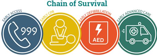
In Northern Ireland there is an average of 1450 “out of hospital cardiac arrests” (OHCA) every year. 2017 statistics show that only 8.9% of these patients will survive and evidence based practice shows this does NOT have to be the case. By providing access to an Automated External Defibrillator and basic Cardio-pulmonary resuscitation (CPR) skills, lives can be saved within our communities.
If a new AED is registered it takes up to 4 weeks for the map to be updated.
Northern Ireland Ambulance Service has advised that in an emergency you should always call 999, and you should never use this tool in an emergency.
Link to map: https://niamb.maps.arcgis.com/apps/webappviewer/index.html?id=1f3c3a534b854738b2d4f685715198ff
Back


